GIS mapping - personal projects
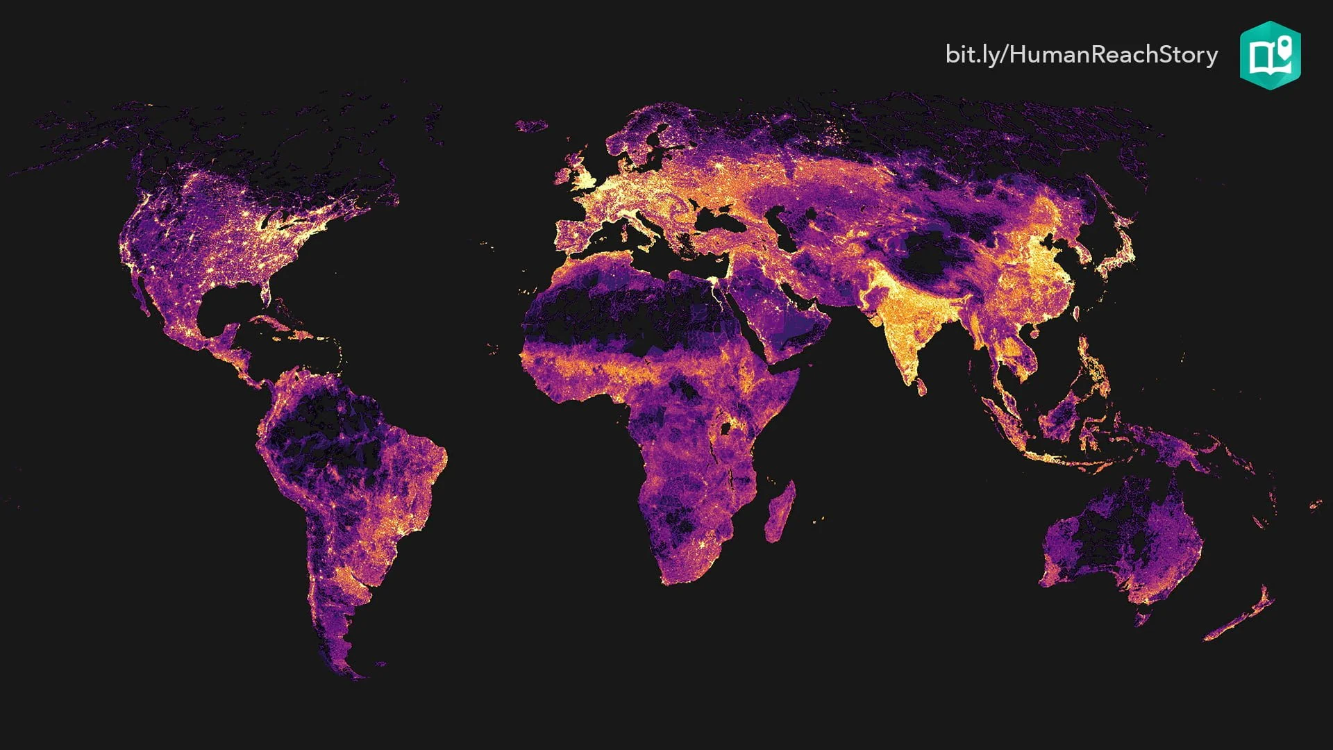
GIS is more than just a professional tool for me: it’s a passion. Beyond my day-to-day work, I actively sharpen my geospatial skills by analyzing land use and demographic trends, leveraging datasets from the U.S. Census Bureau to uncover hidden patterns and spatial relationships. Whether mapping urban development, transportation, or socioeconomic disparities, I enjoy transforming raw data into dynamic visualizations that tell a story. These personal projects not only deepen my technical expertise but also fuel my curiosity about how spatial analysis can inform smarter planning and policy decisions.

Population Density in the Washington D.C. Metropolitan Area

Density is Key: 3D Transit Maps

Population Differences in the Atlanta Region vs. Chicagoland

City of Champaign Racial Distribution

Zillow Home Value Index (HDVI) by Zip Code in Illinois
