Population Density Differences in the Atlanta Region vs. Chicagoland
Growing up in Forsyth County, one of the far-flung northern suburbs of Atlanta, I became intimately familiar with the realities of urban sprawl and its profound impact on the built environment, transportation, and daily life. While the Atlanta metro is widely recognized as one of the most sprawling regions in the U.S., the sheer scale of its low-density development, even in the urban core, remains striking when compared to more compact cities.
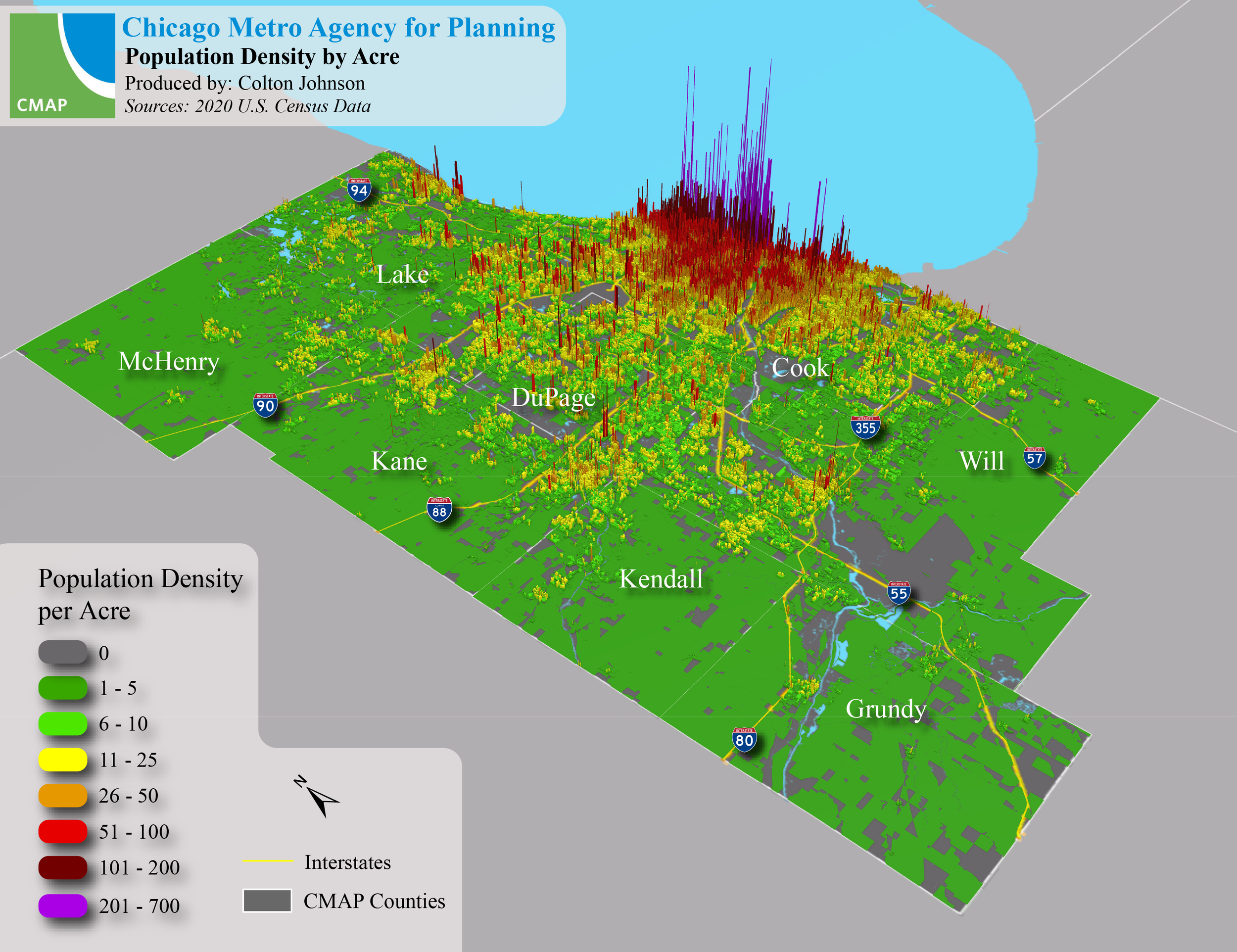
These two maps illustrate population density per acre at the U.S. Census block level, revealing stark contrasts between Atlanta and Chicago. What stands out immediately is the relatively small footprint of Atlanta’s urban core compared to Chicago’s, which boasts a far denser and more continuous concentration of residents, particularly along its lakefront. This disparity isn’t just a matter of geography—it has tangible consequences. The extreme decentralization of Atlanta’s population undermines the efficiency of public transit, perpetuating car dependency, while Chicago’s density supports a more robust and sustainable transportation network